It is here that the Okanagan grasslands, forests and mountains are bound together by the sustenance of life – water. Exploring this eastern edge of the North Okanagan provides adventurers a chance to find worlds hidden within the remote valleys of this place.
This two part Bearfoot Canada series has been produced by the Watershed Intelligence Network in partnership with the Cascadia Conservancy.
PART 1
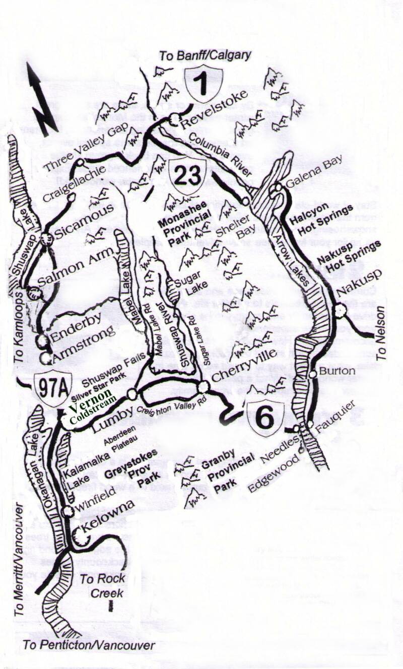
MAPS
We welcome you to explore with us the Undiscovered Country, a documentary featuring stories and experiences as we journey into the Coldstream and Monashee.
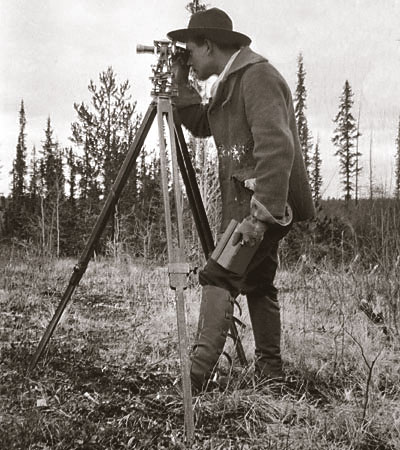
Within this expedition, Dawson was tasked to create a geological map of the southern interior of BC. He would survey the peaks and the valley bottoms of the Monashee, Okanagan and into the Shuswap. With the help of Indian guides he and his men had navigated the area of the Upper Shuswap.
Upon examination of his map that he created in 1877 it becomes apparent that guesswork emerged in this vast territory with its many natural obstacles. In the vicinity of what is now known as Sugar Lake, then called Low Valley, he shows the beginning of the Shuswap River which he then has meandering south and then east emptying directly into Shuswap Lake but missing the existence of Mabel Lake. Perhaps when he returned to the high vantage points overlooking the watershed he had mistaken Mabel Lake for Shuswap Lake?
It’s hard to say what resulted from his error, but for the many who may have followed the map into upper Shuswap, encountering Mabel Lake and mistaking it for Low Valley could have resulted in confusion and may have left the headwaters of the Shuswap largely unexplored for a number of years.
Regardless of such mistakes many of Dawson’s accomplishments remain unparalleled and very important to BC’s history, as a photographer he was one of the first to photograph the landscape and First Nations here. As a scientist he made key observations as to how the Okanagan and Shuswap Indians lived. His native guide during this work referred to him as, "Skookum Tumtum" meaning "brave, cheery man."
(30)
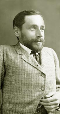
George M. Dawson
Early Bushwacker in the Monashee
By Don Elzer
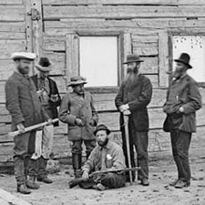
The term “bushwackers” rose out of the guerilla warfare practiced during the American Civil War, but by the late 1800’s a bushwhacker described a person in a different kind of battle, one that pitted the natural underbrush in the backcountry with explorers given the task to define borders, claims, and settlement. Navigating remote wilderness areas overland without a map or trail was an onerous task. One of the most extraordinary bushwhackers was George M. Dawson one of the first surveyors to navigate throughout British Columbia, today Dawson Creek and Dawson City in the Yukon both bare his name.
Dawson was of small stature, as a child he was inflicted with tuberculosis of the spine (Pott's disease) that resulted in a deformed back and impeded his growth. However, physical limitations did not deter Dawson he became known as "Dr. George" and went on to become one of the most outstanding scientists Canada has ever produced, building the basis for much of the geological and botanical knowledge of western Canada. In 1874, Dr. Dawson is said to have made the first discovery of a dinosaur in Canada
the lost lake...
Dawson began his career in the 1870s, one of his first major projects was being involved with the International Boundary Survey of 1872 to 1876 that marked the border and undertook scientific studies along the way. During the course of the survey he gathered information that was eventually published as a 387 page "Report on the Geology and Resources of the Region in the Vicinity of the 49th parallel from the Lake of the Woods to the Rocky Mountains."
our sponsors
Deuling & Company Lawyers
Hodge & Associates
Reality Based Accounting
Cozy Cabins Nature Resort
Bloom Wellness Centre
Keefer Lake Resort
Miracles & Hair Design
Dott’s Chocolate Shop
M-T Ranch WoodCraft
Doug Brown
Chartered Accountants
The Wildcraft Forest
The Cascadia Conservancy
Elzer Family Community
Media Fund
Westcoast CED Consulting Ltd.
Please support our sponsors who made this documentary series possible.
This online documentary is available for viewing from September 23rd
to November 30th 2009
The Cascadia Conservancy promotes a healthy and sustainable environment for rural British Columbia. We link the protection and enhancement of natural eco-systems with human settlement that includes a vibrant local economy.
We are a proud partner of this production The Undiscovered Country
Stewardship & Community
Find our latest productions in our program guide called Cafe.
PART TWO
Begins October 15th
Mistical Sacred Places
Top of the Kettle
Gold Fever & Ghosts
Airheads in Flight
Landscape at Risk
Kids Travel Pack
7 Days of Adventure
Map Links and route downloads. Explore roads and trails
The Undiscovered Country is a production of the Watershed Intelligence Network.
The Watershed Intelligence Network creates and manages information power tools for a changing planet. Watershed produces online documentaries for broadcast within its own online network as well as other independent and publically owned media outlets.
This documentary series was made possible through individual contributions and sponsorship support by community owned businesses and not-for-profit foundations.
If you would like to support the Watershed Intelligence Network please visit our contribute page.
The content within this documentary series cannot be reproduced without written permission from the Watershed Intelligence Network – please contact us.