As I begin my journey to explore the beginning of water courses in the Okanagan I new that the Aberdeen Plateau would be symbolic of this historical difference in how the land continues to be used. I ventured forth knowing this landscape, where the forest becomes a treasure as a place where wilderness creeps close to the fence lines of hobby farms bound together by ribbons of country pavement.
I climbed out of the Okanagan from Lavington and traveled on a dusty meandering Forest Service road that displays a sameness is it becomes locked-in by timber that straddles on both sides of the road. It was a hot day and the white dust seems to have an amplified the heat as it creeps through the air vents of the truck and coats everything including my bronchial air passages.
There’s not as much traffic on the road as I thought there would be, but that shouldn’t surprise me. I hear of fewer people talk about coming up this way. There was a time when the Aberdeen was bursting at the seams with weekend campers, but those numbers have become less in recent years. Quite surprising since this is a recreation playground within close proximity to Vernon, perhaps a resource not realized by a lot of newcomers. Or maybe this place has simply been forgotten by most.
The watershed as a form becomes evident as I approach near the summit of this wide forested plateau which is between 4600 and 5000 feet (1400 meters). As the road levels out it becomes apparent that the plateau isn’t entirely flat; the forested horizon has a rolling quality. Road signs are apparent, they’re asking me to be careful and appreciate that I’m in the midst of a place that provides thousands with drinking water. This upland water source is the main supply for many Vernon and Coldstream area residents. Duteau Creek is supplied by three upland reservoirs on the plateau that includes Aberdeen, Grizzly and Haddo Lakes. Deer Creek and Goose Lake also feed water into the system seasonally.
The water from Duteau Creek is symbolic of the challenges the Okanagan water supply faces throughout the valley. It’s one where the elements of human activity come into conflict with one another. Duteau Creek has become a very coloured source of water which creates aesthetic and health concerns among residents as they turn on their kitchen taps. I think the colour in Duteau is natural. It's not 'occasional' -- it's there all the time probably from mineral content and mostly colour leached from organic matter in the lake bottoms which can include natural iron, humus, peat material and plankton.
But sometimes the colour becomes far worst as the water turns brown causing boil water advisories. In order to meet the aesthetic objective within the Canadian Drinking Water Guidelines, a higher level of treatment than is currently available is required which has resulted in Greater Vernon Water initiating a number of water improvement projects.
There's more than an aesthetic concern, however. The real danger is the runoff from clearcuts in the spring which loads the creeks with silt and organic matter. Chlorinating then becomes problematic, and maintaining adequate levels for safety becomes a concern and solving the problem continues to challenge water authorities who seem to have little control over the logging high up in the Aberdeen.
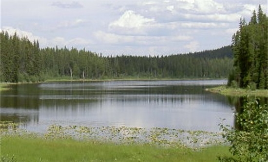
As the road levels off, the beetle killed forest begins to merge with the expanding width of the road. I was now driving on an industrial corridor, it was a Sunday so logging trucks wouldn’t be likely, but really one never knows. The first lake also becomes visible so I decided to stop. This area is like a sponge so the water level on lake a can become a rough indicator as to just how soggy this sponge is. All the water collected from snowmelt and rain gathers here which then provides the water that we drink. It is a sensitive ecosystem because it is for the most part stagnant water not fed by alpine streams or glaciers.
The water level seems rather low to me.
My observation point was not a grassy shoulder on the road, nor was it the edge of the lake, it was a junction of a logging road; a collection of ruts gouged a boggy turnaround. There were ATV, logging truck, 4X4 and many other kinds of ruts all gathered together to catch the rain and display their own contribution to water storage. I tried hard to find some deer tracks in this mechanical mix, but found none – this immediate place is probably taboo for any four-legged being.
The ditches created by off-roaders are everywhere as are the bullet holes in the signs that direct caution in the watershed, these lawless elements make waste of the territorial government, it is the wild west here, at least some days.
But as a backdrop to all of this turmoil is a curtain of trees that hides for a small lake that represents the calm in a storm of human presence, a place that remains rich in biology. This small lake locks away the secrets of our own survival on this planet as it becomes a source for living beings.
This extensive complex of small lakes, swamps and wetland meadows mixed with forest is unique in the Southern Interior. The Aberdeen Plateau plays a key role in providing mid and late summer range for wildlife when the valley bottom in the Okanagan is no longer productive. This area provides habitat for moose, white-tailed deer and mule deer from spring to fall. Also found in the area are lynx, wolverine, ptarmigan and grouse. Mountain caribou once frequented this entire Okanagan Highlands area but within this past decade have become extinct.
A number of other species are on the brink of extinction here including the fisher, Townsend’s big-eared bat and the grizzly bear. There is one blue-listed plant species called the pink agoseris.
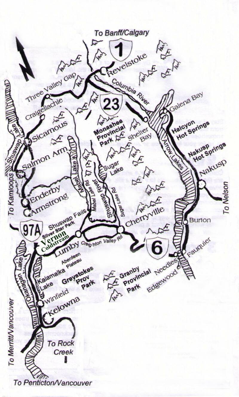
My journey continues as the thin stunted trees finally begin to transform into a more mature second growth forest and another clue emerges within my missions quest. The first bridge appears on the road and beneath it a dry creek bed; it was a bit damp but for the most part there was no water running in this creek, so I decided to investigate farther up the channel. Here were the remains of what appeared to be old irrigation canals. After a century of disrepair they are almost Maya in character as the underbrush reclaims them, but yet this ancient lost quality becomes eager to tell a story - but few will ever stumble upon this place which will require them to take more than a moment to search and listen carefully.
There is a faint trickle of water that sounds like the quiet banter of a conversation, perhaps spirits of those who a century ago, would trek for two days to reach this place. The old remains of what appears to be a cabin can be found close by; perhaps this could have belonged to a rancher minding cattle on the range, or perhaps it was a shelter for the “ditchwalkers” who once maintained the old Grey Canal, or maybe it was a homestead long since a dream put down. An old cabin like this marked a different age where a home was simply a place large enough to keep you from the winter elements. The challenge of earlier days was energy, so smaller was better when it came to keeping a place warm, anyway you could. If you didn’t you would perish. The social safety net back then was measured by how quickly your body would decompose as to not burden your friends with your burial when they checked on how you were doing come Spring.
This time of year, that trickle of conversation I’m listening too is probably all about firewood and whether there’s enough for the winter.
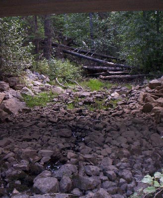
As the road is maintained and widened and as trees are logged, the remnants of this site will meet its finale fate by dozer blade. Something will be lost, these old places explain to us how time loses things; our immediate needs push aside the past unknowingly until those old things are forgotten completely. These old irrigation remnants remind me of the old Hudson’s Bay Fur Brigade Trail which fell victim to the same fate – roads are widened, shoulders are built, all as a result of our need to move more things more quickly. This construction and maintenance that we do, covers the past with a layer of the present. It’s why we always have to dig deep to find the past and even deeper to find the ancient.
The Aberdeen has another rich presence which dots this landscape and is becoming as endangered as any other architecture of the past. For a century, small fishing lodges like the ones found here became the vacation destination for most Okanagan residents, but now while many of these old camps and lodges are still busy, they struggle against competing interests; changing consumer trends; and mostly the changes to the landscape caused by clearcut logging.
And those clearcuts are beginning to be more noticeable along the road again as the mature forest once again dwindles.
Dee Lake Lodge is central to the Aberdeen and is a treasure in the midst of this lake country. This is a piece of Canada that remains timeless. Unlike the clearcuts, the rustic cabins blend with the landscape to become a natural part of it. The weathered dovetailed logs express the same tonal value as the moose antlers nailed above one of the windows.
But there are always differences that humans seem to carry into nature, here those differences can be found in the rental boats as their red hulls cast a perfect mirror image onto the lake. The contrast speaks to the colours we bring into the natural world and our place within everything else.
The lake is calm, but the world here never sleeps, there is a living presence here always, however there is something strange, swallows found commonplace gliding for bugs over the surface of these small lakes are now seldom seen. Now they are beyond our sight flying high in the sky feeding on the clouds of mountain pine beetles - so many that some of the bush pilots say, they darken the sky.
The clearcuts here and those bugs are synonymous as the bug killed pine emerge redish brown in the forest, lighting sticks was what someone called them and the battle fought becomes a harvest of last resort before a fire has its way with everything here.
As I leave the lodge, the closer I get to the main road again; I notice how different this world here can be. ATV’s roar up and down navigating through the clouds of dust from the 4x4’s speeding over the washboard gravel, I proceed with caution. The forest slowly becomes even sparser than before as it begins to meander through a clear cut. I decided to stop and investigate how large this one might be. I climbed to the top of the ridge above the road and through a thin curtain of trees intended to shelter the road from the clearing I discovered it was massive.
It was like a moonscape and a return to the desolation the forest industry practiced in the 1980’s, but today these acts of industry are framed as rescue missions as the little bug casts a shadow on the landscape that will change our part of this planet forever.
But how could we even consider this a watershed, as the surface run-off from this clear cut alone would certainly muddy any drinking source that begins here? In a ravine in the midst of the clearing, water sits stale in amber puddles that might actually be beautiful if it weren’t for the desolation of this landscape. This puddle is symbolic of the death of what was once here rather than the living that had depended on this place..
Would I drink the water? Not without antibiotics close at hand.
By this time I’m on the Lake Country slope of the western most portion of the plateau. Recreation activity becomes more evident as I enter Beaver Lake Resort where a modern tribal village can be found and where the architects of one-with-nature lost the battle with legions of get-away consumers putting into action a panacea of recreational toys which have as a total sum removed this place from the retreat that it wishes to be.
But certainly, people are having fun here.
On this lake the rights of cabin owners is under siege as politicians seek to claim the waters edge for their own devices. One day they hope to expand this lake as a greater source of water for the valley people. If I were them, I would look up-land and study the amber puddles before I sourced this water for drinking.
Some folks in the valley may still believe that this plateau offers all that is pristine in the Okanagan, but the reach from logging trucks and noise from chainsaws during the week is replaced with that of off-road vehicles. This reach has greater impacts on wildlife than hunting season does. It creates nervousness. Predators work harder as prey becomes timid; and animal travel routes are disturbed.
My decent back down to the valley allows me to witness the transformation of the forest into the rolling desert hills above Lake Country. Here human habitat reemerges as does areas poised for development to house more thirsty residents.
This journey has become a lesson in not what might be lost, but what will be lost. But regardless of what the future might bring, from here, the sunset cast over the valley is truly beautiful and for a moment I have forgotten the lesson.
(30)